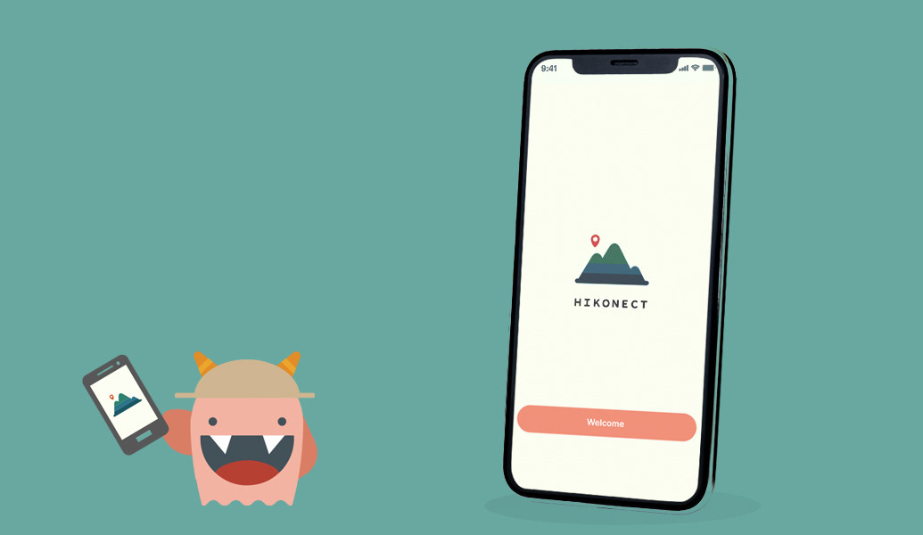
Hike, but stay connected! An offline location map that can help track your and your teammates' location when doing recreational activities outdoors.
Type: Mobile UX Design
Duration: 3 months
Role: UX designer, UX researcher
Tags: Safety, Outdoors, Connection
Duration: 3 months
Role: UX designer, UX researcher
Tags: Safety, Outdoors, Connection
01 Overview
Background:
With more and more people interested in hiking, safety concerns such as altitude sickness and getting lost are put to light. HIKONECT provides a solution, enabling people to stay connected with their group while on a hiking trip. The APP is designed for an outdoor environment with no cellular or internet connection, by people who use smartphones and are familiar with technology.
Key problem:
How to help beginners in outdoor activities learn to stay safe and not get lost without internet connection?
Goal: To help beginners devoted to outdoor activities stay safe and connected, and provide aid when they need.
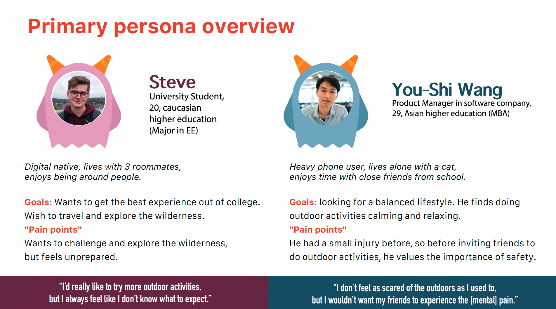
Target Users: Young outdoor sports beginners, age 20-30, who like to be prepared and are conscious about safety measures.
Solution: Offline Location Map
Using GPS functions to help users locate fellow climbers in a team on an offline map.
02 Approach
Learning hiking safety needs from users
6 Interviewees:
- Hiking beginners(1-2 years experience)
- Experienced hiker
- Physical therapist
- Hiking beginners(1-2 years experience)
- Experienced hiker
- Physical therapist
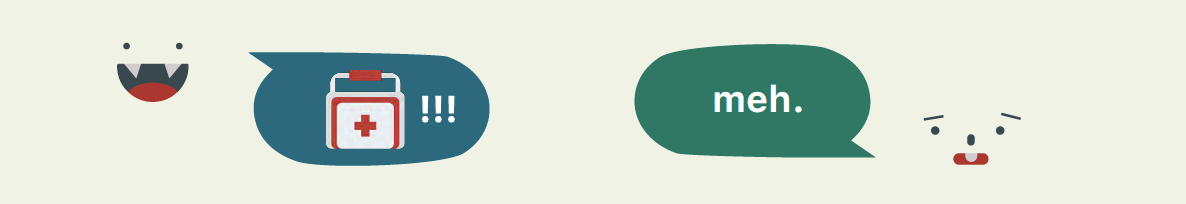
At first, I wanted to focus on first aid practices outdoors. But after interviewing, I've learned that first aid treatment are not something users had in mind. The needfinding process shows that when going outdoors, users mostly have the goal of experiencing nature, work-life balance, and bonding and connecting with other people.
The following are the three top key findings:
1. Beginners in hiking do research mainly on hiking gear and FAQs, but not so much on first aid treatment.
2. Beginners strongly rely on hiking leaders, and more experienced friends while going outdoors, trusting that they can handle emergencies.
3. The biggest concern on safety is getting lost, altitude sickness, and hypothermia.
Getting to know users through personas
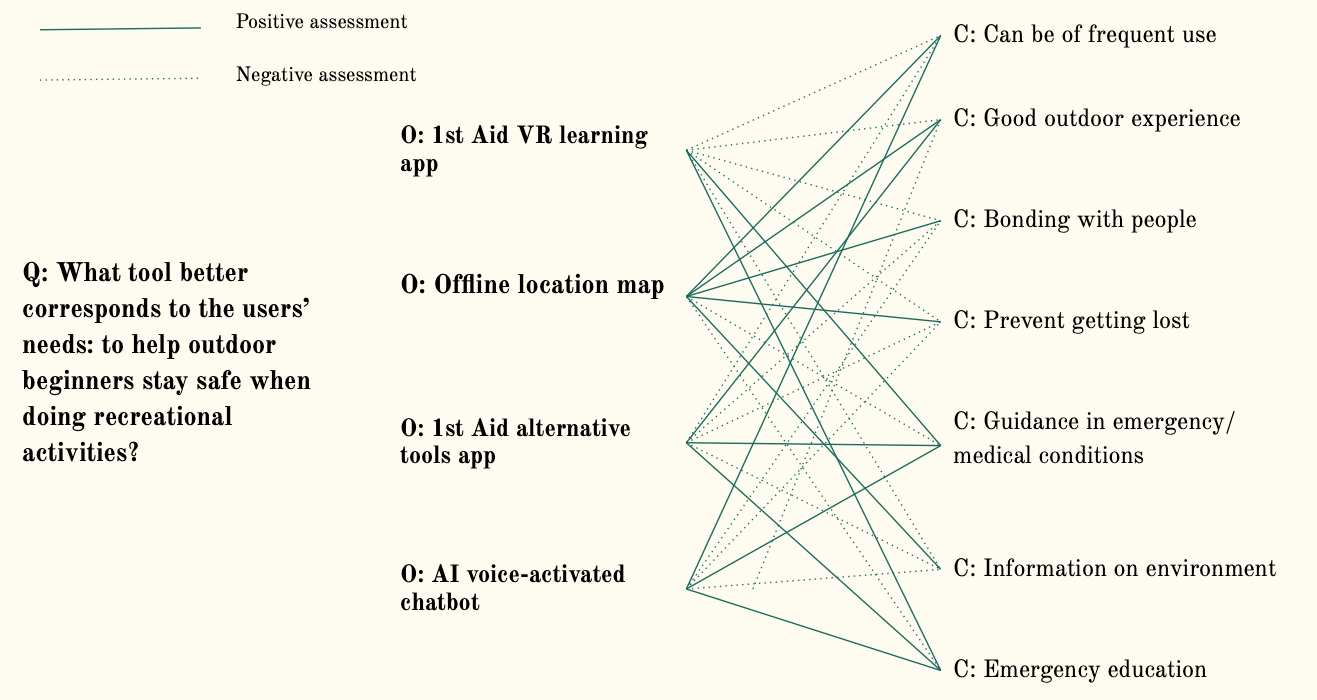
The rationale for design decision - QOC
I used the QOC method (Questions, Options, and Criteria), to decide what would be a more practical project, considering factors such as if the tool could be of frequent use, or whether it can provide aid in emergencies. After looking through four tools, the offline location map best corresponds to the users’ needs
The Solution: Offline Location Hiking map
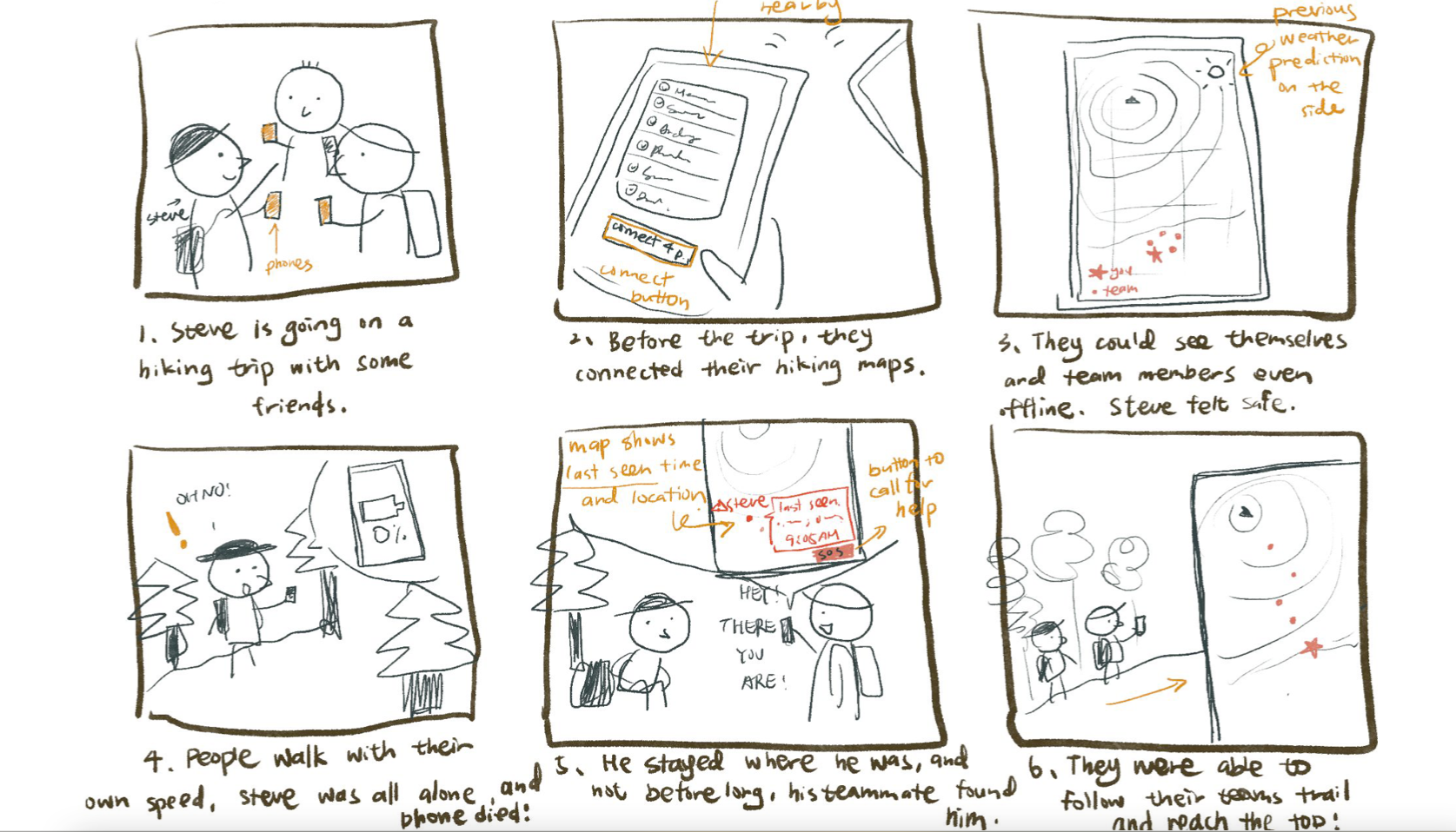
Conceptual and design: Personas, Storyboard/scenario, design concepts
Prototype: Information Architecture, User Flow, Wireframes
Prototype: Information Architecture, User Flow, Wireframes
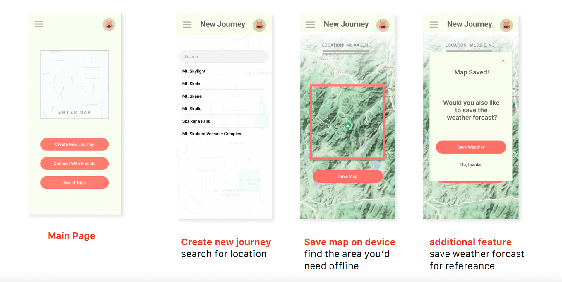
Key function 1 - Save offline maps:
Users can begin a trip by creating a journey. To create a trip, users have to search for the area of the map they want to download on their mobile device, for access when there is no connection. There is also an additional function where they can choose if they want to save the weather forecast as well. Both saving a map and relevant weather information supports the goal of keeping hikers safe and informed.
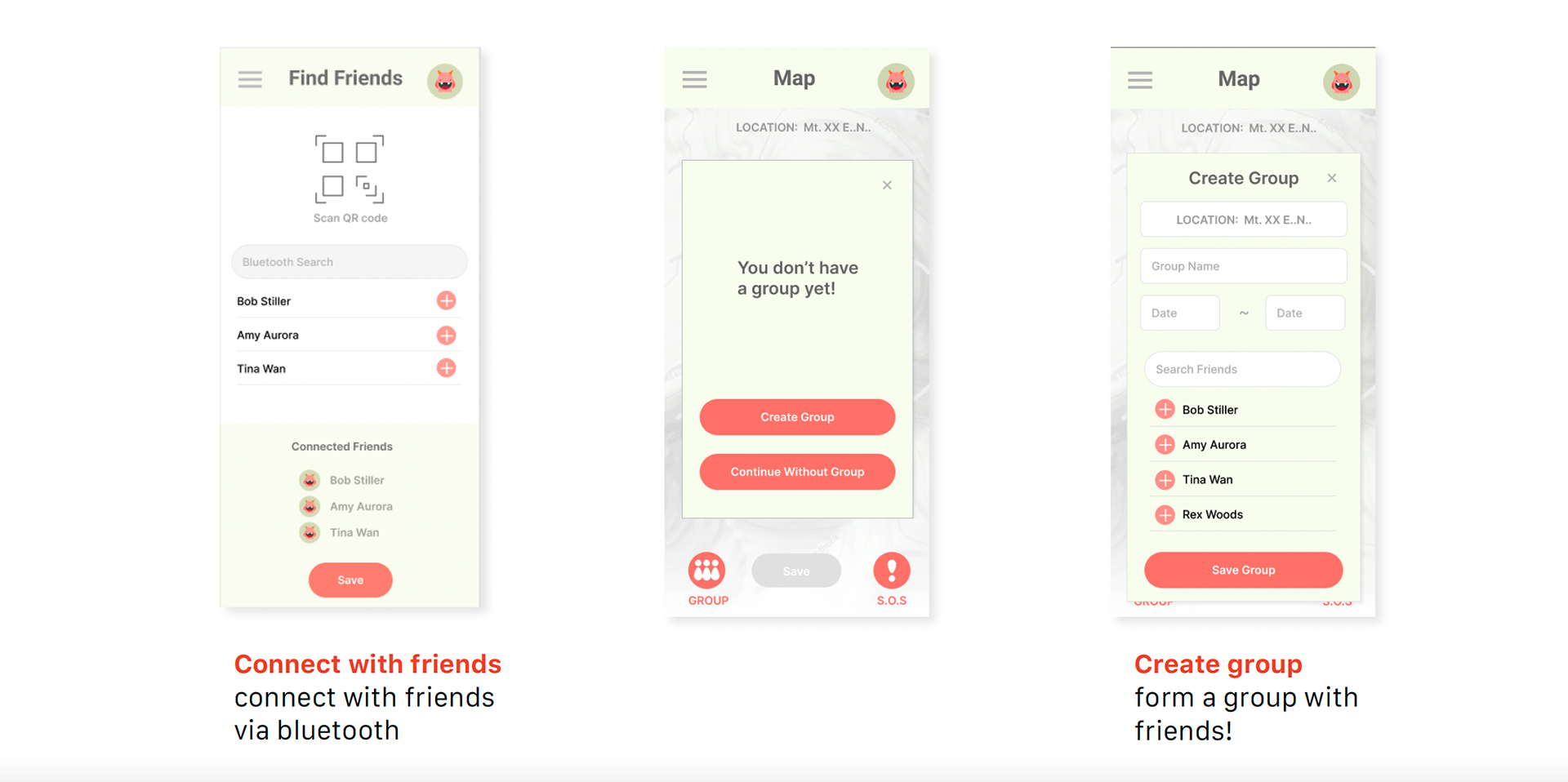
Key function 2 - Connect with friends:
Users can choose to either scan their QRcode or use Bluetooth to connect, and look for their usernames. After finding their friend, they can be added to a friends list, which later on can be used to create a group. A group can be formed by putting in the journey detail and adding friends from the friend list. Once a group is created, you can see each other’s location on the map.
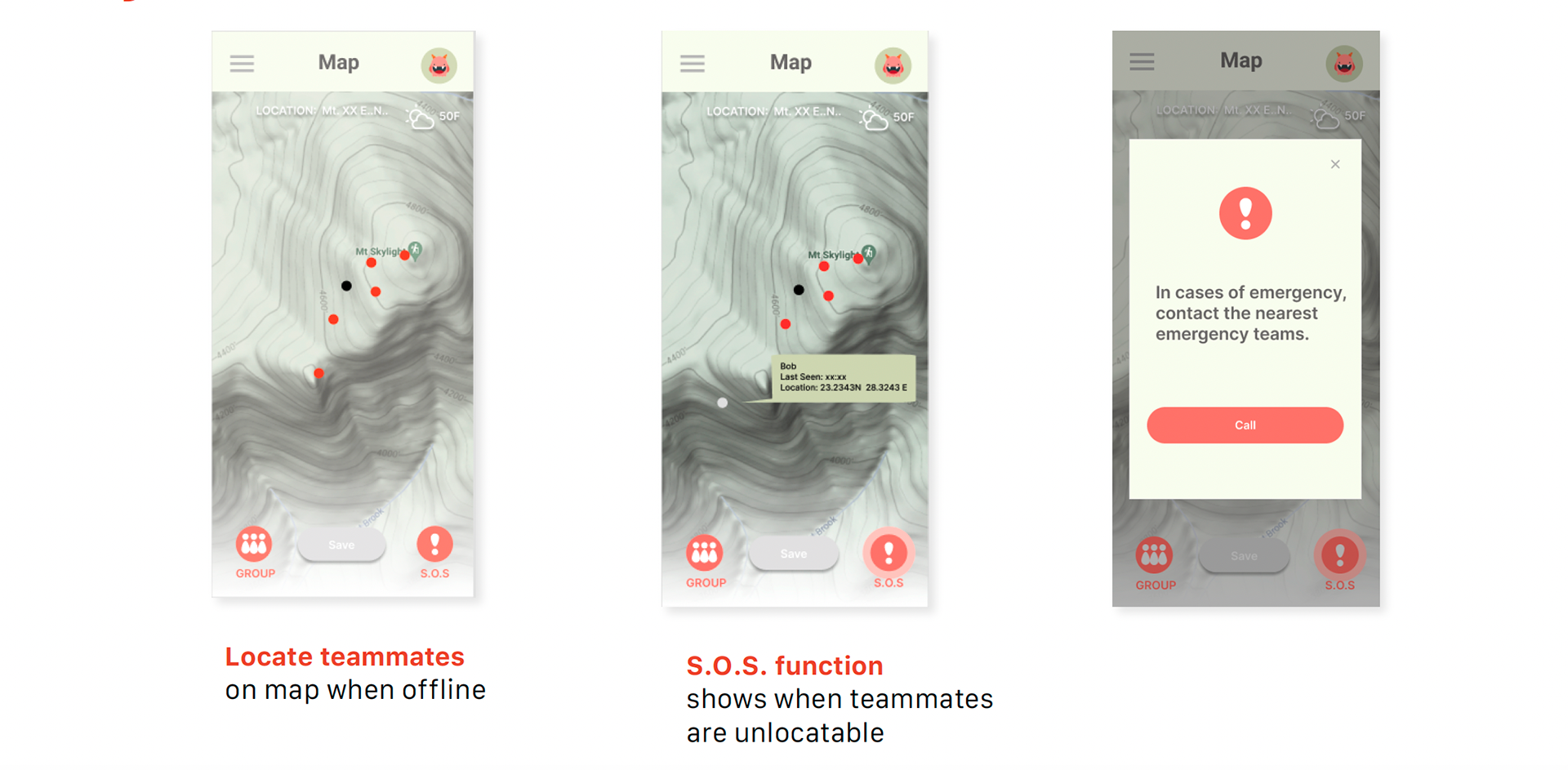
Ket function 3 - S.O.S. function:
Users can see the location and connection information of team members. If a user lost connection, the map would change their status to "disconnected". The S.O.S. button would also light up, so users can have the option to call the nearest emergency teams through satellite phones.
03 Reflections
Challenges and constraints of project
- Technical issues - satellite/GPS
- Legal issues on GPS and information sharing
- Possibly high development cost
Personal Takeaways
This project was very interesting, especially how my project shifted directions according to the users' interviews. Through the needfinding process, I learned more about the users' needs and know what's more practical to them. Such as: People weren't concerned about First Aid skills sets as much!!
Although I am happy with how the project turned out, I still find first-aid knowledge-sharing important. I wonder if I asked more users about needs in the medical and educational field, and having more exploration in the needfindings may lead to other design decisions and impactful results!


